Geography in Machu Picchu, Peru: soil, mountains, rivers and more
The Sanctuary of Machu Picchu is a World Heritage Site (declared by Unesco). And there are many characteristics for which it was named in this way: its privileged location in the Amazonian jungle, the Vilcanota River, the immense mountains and much more. This rich geography led Machu Picchu to be one of the 7 Wonders of the World.
- The landscape surrounding Machu Picchu
- Machu Picchu location and coordinates
- The mountains in Machu Picchu
- The rivers in Machu Picchu
- The soil in Machu Picchu
- The rains in Machu Picchu
- Do earthquakes usually occur in Machu Picchu?
- How to preserve Machu Picchu?

The landscape of Machu Picchu
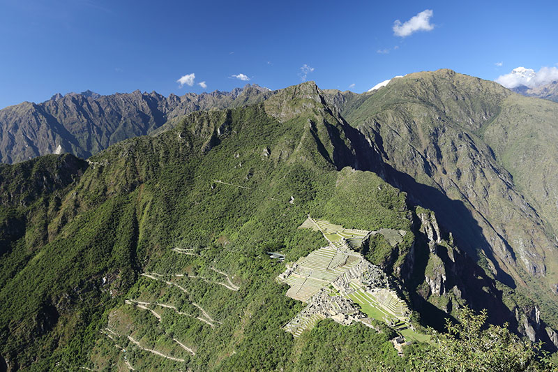
Machu Picchu is located on the eastern side of the Andes Mountains of Peru, at 7,972 feet (2430 m.a.s.l.). There, rainfall is common. The climate varies from 8ºC. to 28ºC. Its geography is characterized by abundant mountain vegetation.
The landscape surrounding Machu Picchu
- The Sanctuary of Machu Picchu is home to numerous archaeological sites and monuments of high historical value such as: the Intihuatana, the Intipunku, the Temple of the 3 Windows, the Sacred Plaza, the Temple of the Condor, etc.
- Seen from the air, the Inca City of Machu Picchu has the shape of the condor, the sacred bird of the Incas.
- Machu Picchu is crossed by 2 mountain ranges: the Urubamba range and the Vilcanota range.
- The Inca City is built on the ‘Vilcabamba batholith’. The main mountains that surround it are: Machu Picchu and Huayna Picchu.
Machu Picchu location and coordinates
- The Inca City is located within the so-called ‘Historic Sanctuary of Machu Picchu’, which has a total area covering 35 thousand hectares (350 km2).
- Machu Picchu is located in the district of Aguas Calientes, province of Urubamba, department of Cusco in Peru.
- Its coordinates are: 13º 10′ 19” and 13º 14′ 00′ (south latitude). It is also located at 72º 30′ 5” and 72º 36′ 33” (west latitude).
The mountains in Machu Picchu
- In total there are 3 mountains surrounding the Inca City: the Machu Picchu, Huayna Picchu and Putucusi mountains.
- The closest mountain to Machu Picchu is the Salkantay (6,271 m.a.s.l.).
- The mountains surrounding the Inca City belong to the mountain range known as the ‘Salkantay Massif’.
The rivers in Machu Picchu
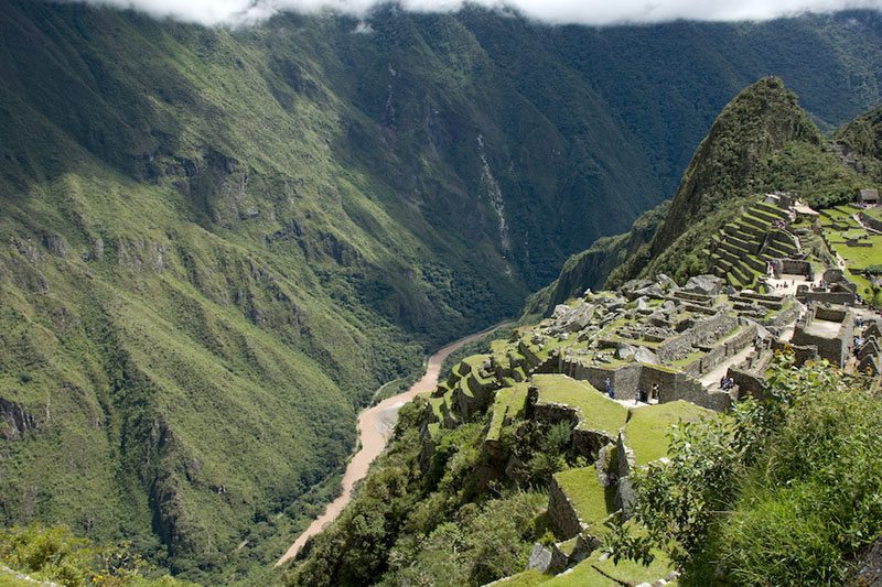
- From Machu Picchu you descend a slope of approximately 500 meters to the Vilcanota River (also known as Urubamba).
- In addition to Machu Picchu, the Vilcanota River crosses other Inca archaeological sites such as Pisac and Ollantaytambo.
- In the Vilcanota River coexist ducks of turrets. In its stones inhabit the aquatic blackbirds as well as other species of birds.
- Between December and April (rainy season) the flow of the river increases considerably. The rest of the year (dry season), the river maintains its usual flow.

https://www.boletomachupicchu.com/gutblt/wp-content/images/geografia-machu-picchu-3.jpg
The soil in Machu Picchu
- The soil at Machu Picchu is made up of mountains of volcanic and sedimentary rocks.
- To protect the soil of the Inca City, Peruvian authorities have implemented a special soil to reduce the effect of the excessive number of visitors each year.
- According to specialists, this new protection system prevented Machu Picchu from sinking up to 15 centimeters.
The rains in Machu Picchu
- In Machu Picchu it rains frequently, especially from December to April. From May to November is the dry season.
- Rainfall varies from 36 mm. to 228 mm. per month. In the rainy season, rainfall increases considerably.
- The constant rains threaten to damage Machu Picchu’s infrastructure. However, the drainage system built by the Incas keeps the archaeological site protected.
- As a protective measure, Machu Picchu authorities decided to close the Inca Trail every year in February. This is due to the fact that this is the month with the most rainfall in the Inca City.
Do earthquakes usually occur in Machu Picchu?
- Machu Picchu, like the rest of Peru, has a geography prone to earthquakes.
- Machu Picchu was built approximately in 1450. Since then, its walls have suffered earthquakes of varying intensity.
- In 1650 and 1950, for example, two earthquakes of intense magnitude were recorded. One of them caused the deformation of one of its most important walls.
- The Incas were aware of the danger posed by earthquakes, so they developed an anti-seismic construction system.
- This anti-seismic system consisted of slightly inclining the walls in order to obtain better support during earthquakes.
The Incas built Machu Picchu in a geography rich in vegetation and of a unique beauty in the world. Because of this, in 2007, the Inca City received recognition as one of the 7 Wonders of the Modern World.
How to preserve Machu Picchu?
- The Peruvian authorities have established certain prohibitions in order to better conserve the soil and the entire geography of Machu Picchu.
- These are some of the measures that seek to conserve Machu Picchu:
- The entrance to Machu Picchu is restricted to a limited number of visitors per day who will enter respecting the established entrance schedules.
- Entrance with trekking poles is prohibited. Only seniors who urgently need them may enter with rubber-tipped walking sticks.
- Access to the Inca City with strollers, shoes with heels or tripods is not allowed.
- Due to maintenance work as well as prevention, the Inca Trail to Machu Picchu remains closed throughout February, the rainiest month of the year.
Advice from people who have been there
 By: Tatty O.
“Beautiful landscapes“
“The geography of Machu Picchu and being there was the most beautiful thing so far. It fills you with pure energy and of course you come back super recharged. You can sit there for hours. Highly recommended and that is why it is one of the 7 wonders of the modern world.“
By Ticket Machu Picchu – Last updated, October 21, 2024