The Inca Trail – Qhapac Ñan
The network of Inca roads (Qhapac Ñan in Quechua) is considered one of the best Inca engineering works that remains to this day. This complex system of roads exceeded 30 thousand kilometers of stretches that covered areas of up to 6 South American countries: Peru, Bolivia, Chile, Argentina, Ecuador and Colombia. Many stretches were the basis for the construction of modern highways. Others are considered protected heritage by the states. One of the most famous stretches is the 39-kilometer route leading to Machu Picchu.
- What is the Qhapac Ñan?
- What was its function?
- Map of the Inca Trail
- History of the Inca roads
- The main roads
- Photo Gallery
- The Inca bridges
- The canal and drainage system
- The Inca Trail to Machu Picchu
- Additional Information
- Frequently asked questions about the Qhapac Nan
The Inca Trail was the network of roads that extended throughout the Inca empire
What is the Qhapac Ñan?
- Qhapac Ñan is a Quechua word that means ‘main road’. It was a system of roads established by the Inca empire, which covered more than 30 thousand kilometers through different geographies located in the current countries of Peru, Bolivia, Chile, Argentina, Ecuador and Bolivia.
- It is worth mentioning that this immense network of roads is famous for crossing the Andes Mountains, from the mountains of Argentina to the mountains of Colombia passing through the city of Cusco, the capital of the Inca empire. This route was built mainly using stone.
- Also admirable is the longitudinal route that ran along hundreds of kilometers of South American coastline bordering the Pacific Ocean. These roads were wider but did not have the consistency of stone but the softness of sand.
- The Inca roads of the highlands and the coast were joined by transversal stretches that, at the same time, forked into other stretches that penetrated jungle regions. In order to traverse these long stretches, the Incas built bridges, tunnels, causeways, walls, stairways, as well as deposits (colcas) and shelters (tambos).
The qhapac ñan road network was declared a World Heritage Site by UNESCO in 2014, after several years of work by the nations of Peru, Bolivia, Chile, Argentina, Ecuador and Colombia. A total of 780 kilometers and 291 archaeological sites were registered. Thanks to this declaration, Inca engineering is recognized worldwide. Likewise, it protects and preserves for the future the Inca sections and enclosures belonging to this network of roads.
What was its function?
The main function of the qhapac ñan was to communicate the city of Cusco, the center of Inca power, with the rest of the provinces of the empire. Likewise, because the roads were built during the expansionist period, they fulfilled a function of political, administrative, cultural and social domination of the recently conquered peoples.
Map of the Inca Trail
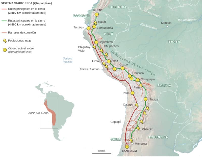
Map of the Inca Trail
History of the Inca roads
- During the pre-Inca period, the different cultures and human groups that inhabited the southwestern territory of South America built some stretches of roads that were improved and expanded during the Inca empire.
- The famous emperor Pachacutec (1400 – 1471) was the one who initiated the Inca expansionist process as well as the construction of the main stretches of qhapac ñan in the new conquered territory.
- The successor Inca emperors continued with the expansion of the Qhapac Ñan as well as the construction of bridges, warehouses and shelters along the roads.
- In the 16th century, the Spaniards arrived in Cusco, destroying the Inca empire and destroying its main temples, palaces and buildings. However, they kept many sections of the qhapac ñan, which favored them for trade.
- Currently, the Inca road network is considered ‘Cultural Heritage of Humanity’ by UNESCO. Many sections are protected by the nations where they are located. One of the most famous routes is the one that reaches Machu Picchu through the Intipunku, the original gateway to the Inca city.
The main roads
- Inca roads of the north coast – This route departed from the city of Cusco heading northwest towards the coast, crossing the present-day towns of Palpa, Nazca, Lima, Huarmey, Lambayeque, Piura, Tumbes, Quito and Pasto in Colombia.
- Inca roads of the northern highlands – This route departed from the city of Cusco, crossing the Andes Mountains in a northerly direction, passing through the current towns of: Vilcashuaman, Jauja, Tarma, Huanuco, Huaritambo, Huancabamba, Siguas, Conchuco, Andamarca, Huamachuco, Cajamarca, Chachapoyas, Tumibamba, Loja, Quito and Pasto in Colombia.
- Inca roads of the southern coast – This route departed from the city of Cusco in an easterly direction to connect to the royal road of the coast (crossing the current towns of Nazca, Palpa, Inca), and then followed the southern road through the towns of Tambo Colorado, Catarpe, Arica, Copiapó, the pampas of Tucumán to the Maule River in Chile.
- Inca roads of the southern highlands – This route departed from the city of Cusco crossing the Andes Mountains in a southerly direction including the Collao plateau. It went through the current towns of Juliaca, Chucuito, Chuquiago, La Paz, the pampas of Tucumán until descending to the city of Santiago in Chile.
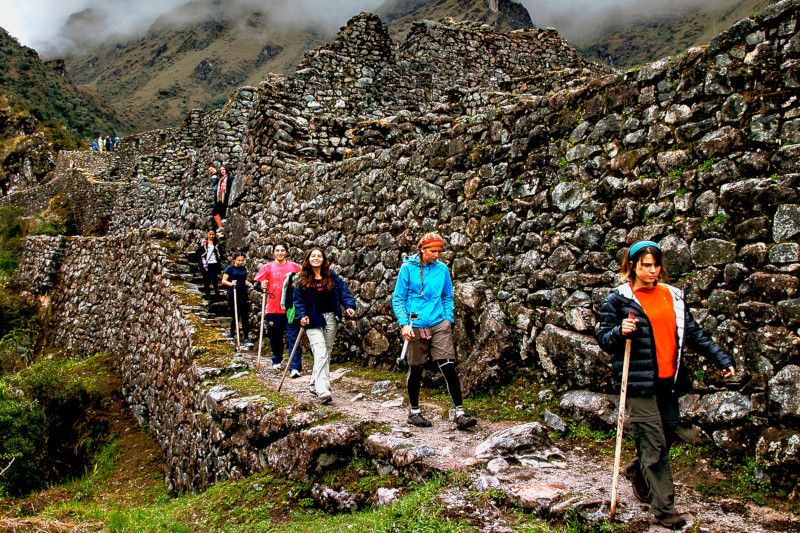
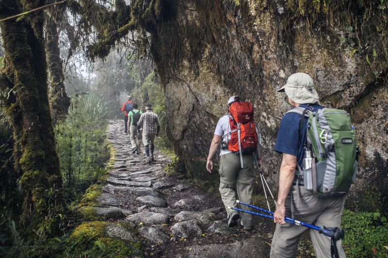
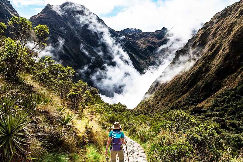
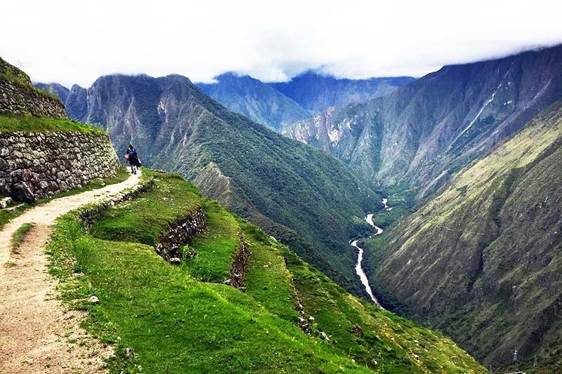
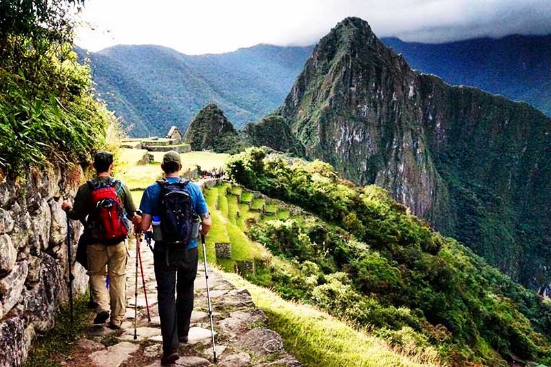
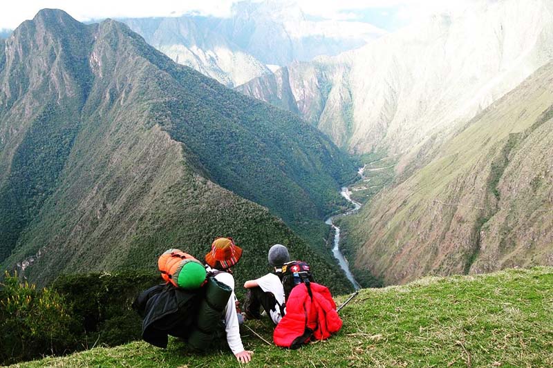
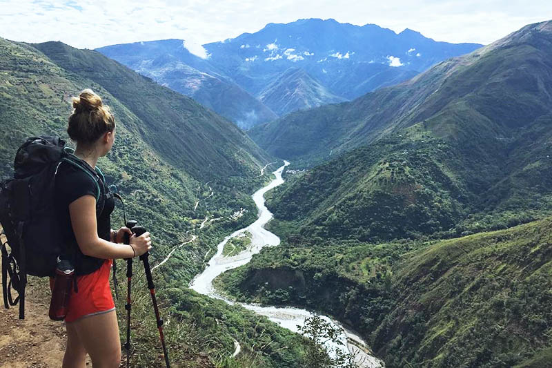
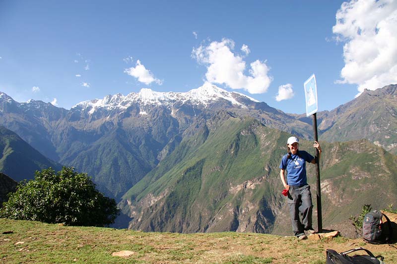
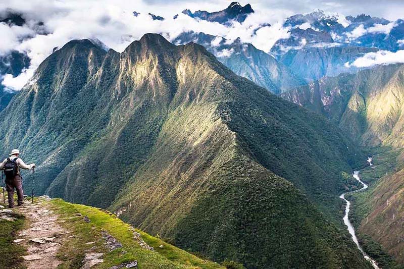
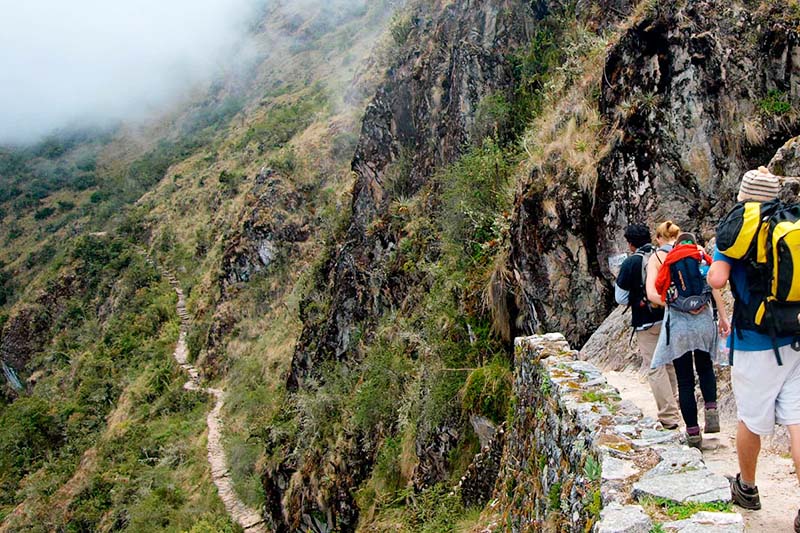
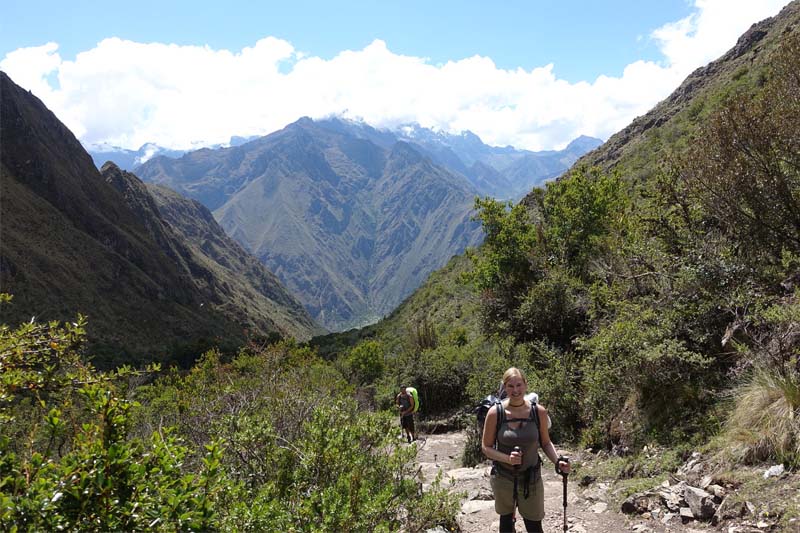
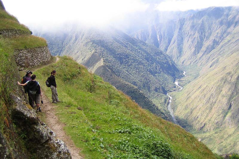
Photo Gallery
The Inca bridges
The qhapac ñan crossed difficult geographies where only the use of a bridge could allow passage. Because of this, the Incas built different types of bridges, which can be divided as follows:
- Log bridges – Rustic and simple constructions that used the trunks of a tree to unify two nearby points. One of the most famous examples is the ‘Inca Bridge’ located at Machu Picchu.
- Hanging bridges – Constructions made of thatch joined together to form long rope bridges, which reached up to 60 meters in length. They had to be renewed from time to time. One of the most famous that survives to this day is the Inca bridge of Queswachaka.
- Stone bridges – Constructions made of rustic stone placed one on top of the other to form a solid path to cross short distances over precipices. Due to the passage of time, most of these types of structures were destroyed.
- Oroyas – Simple construction made of solid vegetable fibers that served as pillars, which carried people or food in a basket or board. They were mainly used to cross rainforest rivers. They are still used today in some communities.
- Floating bridges – Structures made of totora reeds (plant located on the islands of Lake Titicaca), which together served to transport people by water. They were used to navigate from one island to another in this Peruvian lake. Nowadays they are also used for the construction of simple boats./li>
The canal and drainage system
- The qhapac ñan made of stone that crossed the Andes Mountains had a system of drainage and canals that kept it solid in time and in spite of the frequent rains.
- For the construction of a section of the qhapac ñan, first a layout and foundations were laid. Then, the paving was done (preferably of stones). Finally, the drainage system was built together with the canalization. The roads were also maintained from time to time.
Inca roads built in the midst of the mountains
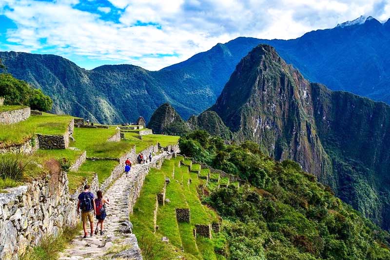
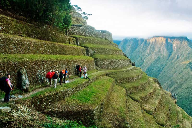
The Inca Trail to Machu Picchu
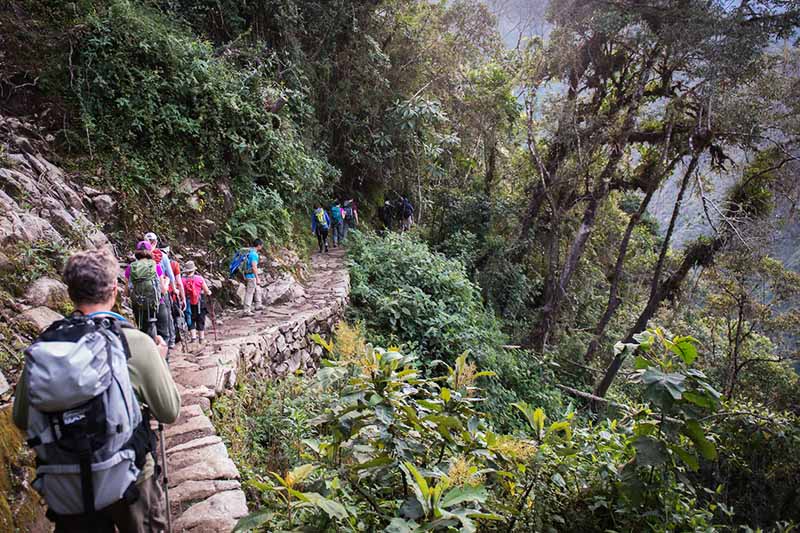
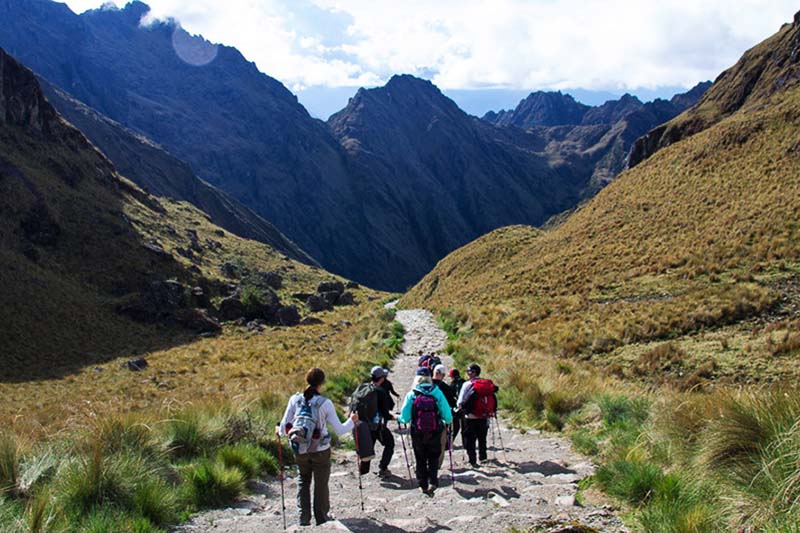
- The most famous stretch of the qhapac ñan in the world is the ‘Inca Trail to Machu Picchu‘. This route was used by the Incas to access the Inca city from Cusco. Currently, it is a route protected by the Peruvian State, which allows controlled tourist visits.
- The Classic Inca Trail to Machu Picchu lasts 4 days and 3 nights. It covers 39 kilometers on foot, from kilometer 39 of the train track in Ollantaytambo to the Intipunku (sun gate), the entrance to the original Inca city.
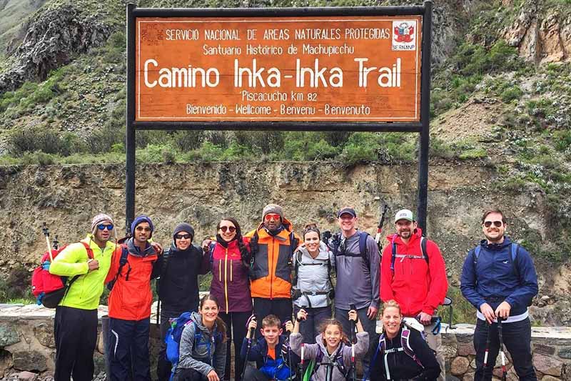
- To do this route you must book a tour with an authorized tourism agency. The tours include everything: entrance fees, food, camping, guides, transportation and more.
- Because this is one of the best trekking routes on the planet, the tour must be booked online 5 to 6 months in advance.
The Inca trail in the middle of the jungle brow
Additional Information
- The apachetas were offerings that the Incas made during their journeys along the Inca roads. They consisted of placing one stone on top of another to invoke good luck for the long journey. This custom is still in force in the Andean peoples, who still worship the mountains (Inca gods).
- For the construction of the qhapac ñan, the Incas adapted to the geography. On the coast the roads were wider. In the highlands they meandered through mountains and in the jungle they crossed narrow cliffs. However, they always took care of nature, finding harmony between the roads and the natural life around them.
Frequently asked questions about the Qhapac Nan
1) Where are the Qhapac Nan?
The Qhapac Nan are located along more than 30,000 kilometers in the current territories of Peru, Bolivia, Chile, Argentina, Colombia and Ecuador.
2) Where can I visit the qhapac ñan?
The qhapac ñan can be visited along the protected areas of Peru, Bolivia, Chile, Argentina, Colombia and Ecuador. The most famous stretch is the one that connects with the Inca city of Machu Picchu.
3) Who built the qhapac ñan?
The qhapac ñan were built by the Incas during the 15th century. The emperor Pachacutec was the one who began to organize the construction of these roads.
4) What was the function of the qhapac ñan?
The qhapac ñan had the function of uniting the city of Cusco (capital of the Inca empire) with the rest of the newly conquered provinces and regions of the empire.
5) How much does it cost to visit the qhapac ñan?
The qhapac ñan do not have a specific cost. Some sections are adequately preserved to be visited by tourists. The most famous stretch is the 39 kilometers of qhapac ñan that connect with Machu Picchu.
6) Do qhapac ñan exist on the coast?
Yes, the Incas built qhapac ñan on the Pacific coast. These roads were flat and delimited on both sides. Due to the sandy terrain many stretches have disappeared over time. The qhapac ñan in the mountains (Cordillera de los Andes) are the best preserved.
7) Do qhapac ñan exist in the jungle?
No, the Incas did not build stretches of qhapac ñan in the thick South American jungle. On the other hand, they did build sections in the high mountainous jungle.
8) Can the qhapac ñan disappear?
Without due care, qhapac ñan can give way to highways and modern buildings. However, the authorities of each country implement measures for their conservation. Currently, the qhapac ñan are considered Cultural Heritage of Humanity by UNESCO.
9) What is the most famous section of the qhapac ñan?
Definitely the most famous stretch of the qhapac ñan is the 39 kilometer stretch that runs through the mountains and jungle region of Cusco until it ends at Machu Picchu.
10) What are the qhapac ñan made of?
The qhapac ñan is made of different materials, but among all of them, stone stands out. The Andean sections are cemented by several layers of stone. This keeps them in a good state of preservation until today.
Advice from people who have been there
 By: Viviana M.
“Incredible“
“It is one of the most strenuous and wonderful routes to Machupicchu; it has everything I expected from a great hike, landscapes, flora, fauna, as well as shady Inca constructions.“
By Ticket Machu Picchu – Last updated, August 16, 2024